Welcome to FlyingNav!
FlyingNav is an advanced Android application designed to enhance flight navigation, weather awareness, and overall situational awareness for pilots, glider enthusiasts, and aviation hobbyists. Whether you’re a seasoned pilot or just beginning your aviation journey, FlyingNav provides you with the tools and data you need to plan, execute, and analyze your flights with confidence and precision.
Overview
FlyingNav is more than just a normal flying app; it’s a comprehensive flight management system for your mobile device. It integrates a moving map system, GPS tracking, airport, airspace, navigation aids and obstacle information, all in an intuitive interface. The application leverages advanced technologies like OpenAIP data integration, and robust GPS and sensor integration to deliver a powerful and versatile flying companion.
Core Features
FlyingNav offers a wide range of features to support various aspects of flight planning and execution:
1. Interactive Moving Map
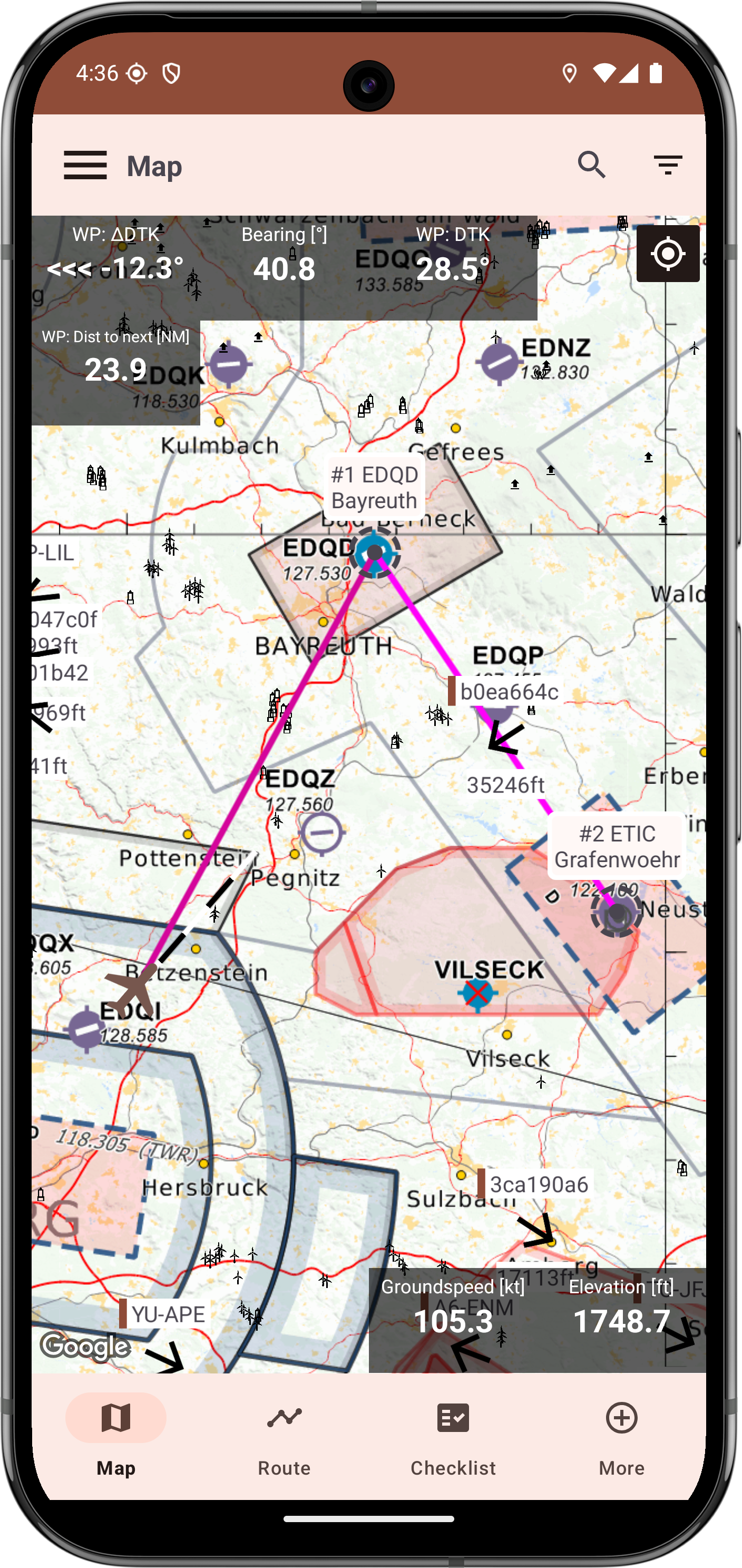
- Detailed Aeronautical Charts: Navigate with confidence using detailed aeronautical charts, including airspace boundaries, airports, runways, and navigational aids.
- Terrain Views: Comming soon: Get a clear understanding of the surrounding terrain with customizable elevation and terrain map layers.
- Customizable Map Layers: Choose which map elements are displayed, including airspace, weather overlays, airports, and more, for a tailored view.
- Intelligent Map Selection: Choose wisely what you want to select with a filterable popup
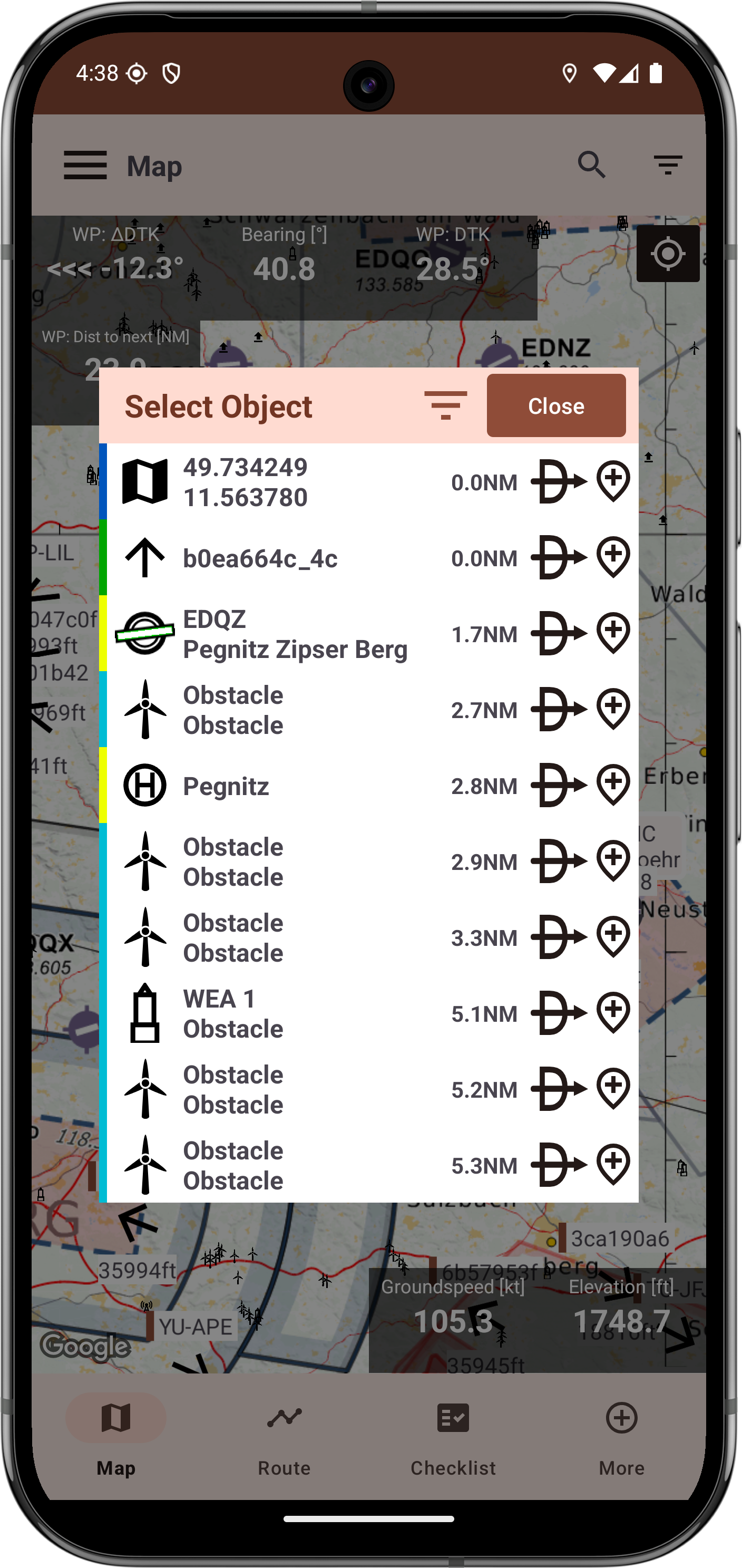
- Global Seach: Search for all of the available data with the help of the global search
- OGN data: Have a look at all your surrounding traffic data (requires internet) and get detailed informations!
2. GPS Navigation
- Real-Time Aircraft Position Tracking: See your current location and track your flight path in real-time with accurate GPS tracking.
- Route Planning: Plan your flights by creating custom routes with waypoints and flight legs.
- Waypoint Management: Add, edit, and manage waypoints for precise navigation and planning.
- Nearest Airports: Quickly find the nearest airports to your location.
3. Airspace Awareness
- Dynamic Airspace Display: Visualize controlled and restricted airspaces directly on the map.
- Airspace Alerts: Receive alerts when approaching or entering restricted or controlled airspace.
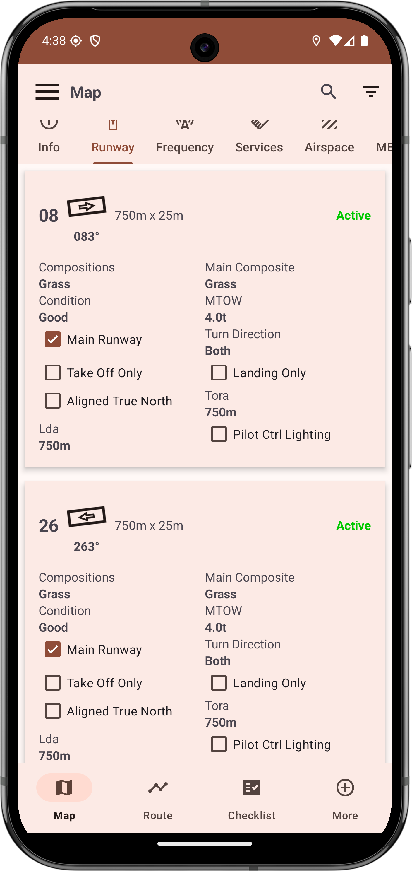
4. Airport Details
- General Information: Get an overview of the selected airport
- Available Runways: Get a detailed list of available runways and their conditions
- Frequencies: Look up the relevant frequencies for this airport
- Services: Do you need some fuel? What about Glider-Towing? Have a look at all the available local services
- Airpsaces: Have a look at the surrounding airspaces to make sure you know where you are flying
- METAR and TAF Integration: Access up-to-date METAR and TAF reports for airports, providing crucial weather observations and forecasts.
5. Flight Management
- Flight Logbook: Keep a detailed logbook of your flights, including dates, times, routes, aircraft used.
- Logbook Review: Review and analyze your past flights with a clear overview of each journey.
6. Flight Preparation
- Database Updates: Regularly update the database with new information about airports, airspaces and much more.
- Scratchpad: Take quick notes with the scratchpad.
- Airport Charts/Plates: View and import various airport charts and plates.
- Ground profile: Download ground elevation data.
7. Settings and Customization
- Unit Selection: Customize your units for distance, altitude, speed, and more.
- Map Preferences: Tailor the map view with various display options and settings.
- Data Display Options: Choose which data points are displayed on the screen for a clutter-free experience.
8. Additional Features
- OpenAIP Integration: Access to a vast database of airports and airspace information through OpenAIP.
- Dark Mode: Switch to a dark theme for low-light conditions.
- Aircraft: Manage your used aircraft.
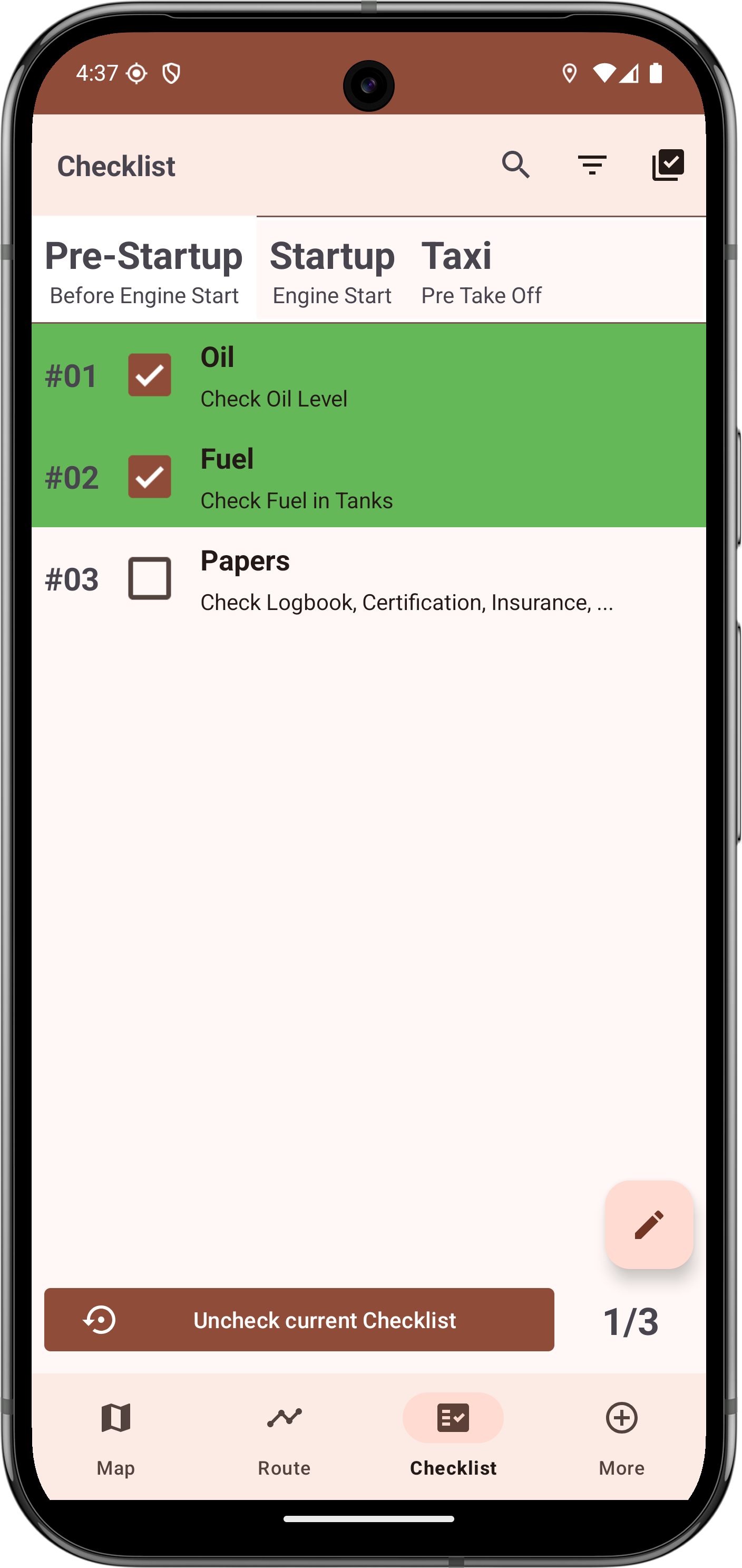
- Customizable Checklist: Add you custom checklist with different sections and items.
- Semicircular Rule: View at which altitude you have to fly.
And much more…
Target Audience
FlyingNav is designed for:
- Private Pilots
- Glider Pilots
- Flight Students
- Aviation Enthusiasts
Getting Started
To get started with FlyingNav, follow these steps:
- Google Play Store
- Install the app on your Android device.
- Download the required Database files for your location
- Explore the various features and customize the settings to fit your needs.
- Take to the skies with FlyingNav as your navigation companion!
Contribute
We welcome contributions from the community! If you’re a developer, pilot, or aviation enthusiast, and would like to help improve FlyingNav, contact me at the email provided below
Contact
If you have any questions, feedback, or need support, please feel free to Contact me